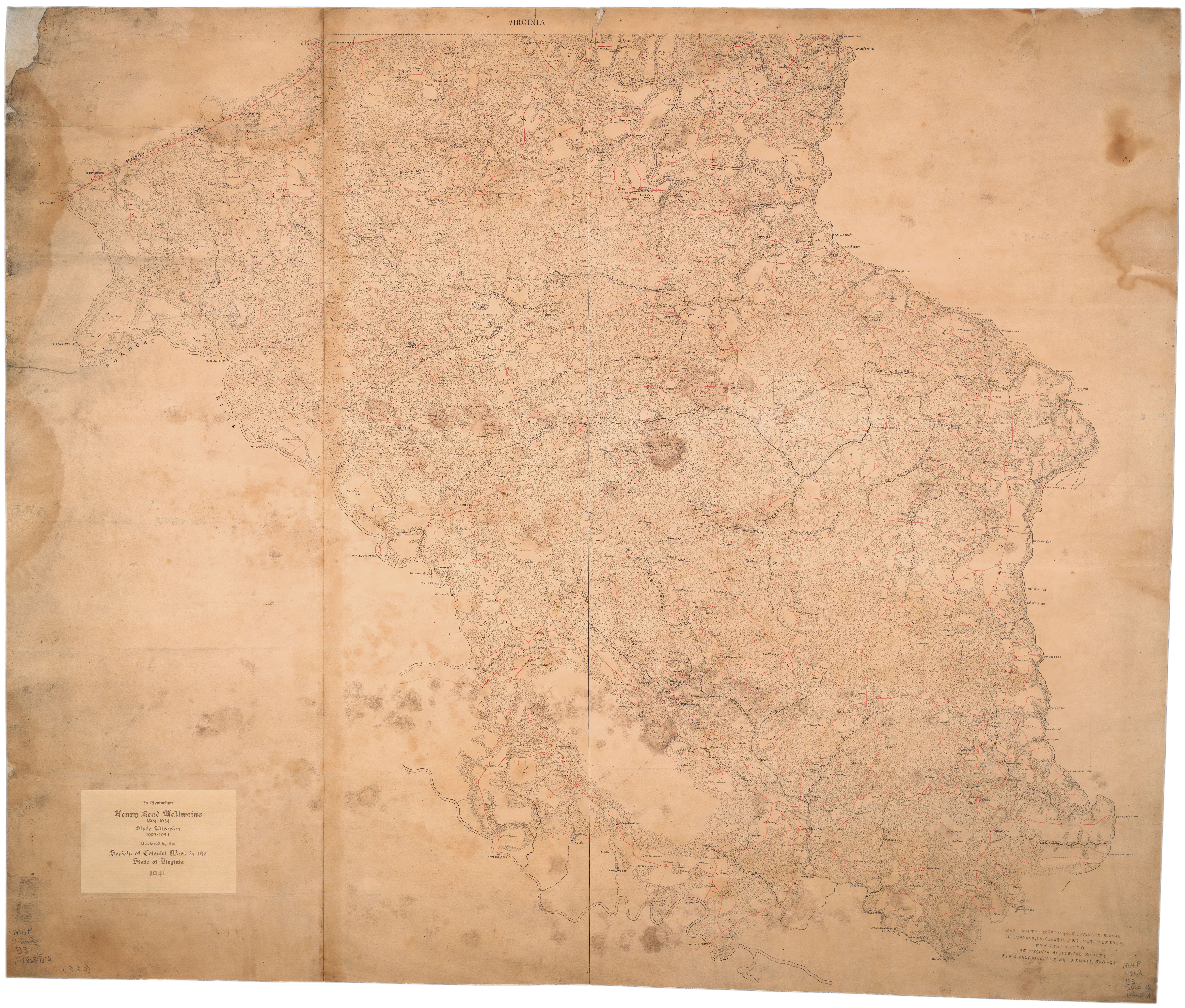
Roanoke R. to Chowan 1863 Civil War map
I found this map here:
http://memory.loc.gov/cgi-bin/query/S?ammem/gmd:@filreq%28@field%28STATE+@band%28north+carolina%29%29+@field%28COLLID+cwmap%29%29
This covers many of the NC folks I research and is probably the earliest somewhat accurate map after the Moseley 1733 and the Collet 1770…
If you get excited to download one of these maps there is a bit of a problem… the format the Lib of Congress presents them (jpg 2000) is defunct now. Worthless as a buggy whip. I “placed” the downloaded file into Adobe Illustrator and then saved it as a PDF… then imported it into Photoshop and sized for this site. If you don’t have the Adobe products then you are pretty much screwed. Unless someone else has figured out another workaround?
I’m playing around with some names… not sure where this will go? I’m thinking of trying to place all the folks from the 1720 Patterson roster…
I try to find some facts to place a name- I don’t have access to the actual deeds, otherwise I would plat them.
Comments are welcome… such as the “Boons”… there is not to be found (so far) any proof that the Thomas Boon from IOW is actually related to the NC Boons. Common sense says they are but… Genealogy Rules being what they are it can’t be stated as “fact”… the search goes on…

——-
some folks around the mouth of Wiccacon Creek…
Chowan Precinct, Abstracts, 1696-1723, Hofmann
#56 pg. 29 RICHARD BOOTH of Chowan Prect. with the free and voluntary consent of my wife ELIZABETH to WILLIAM EARLY of the same place 17 Mar. 1701/2 for 4500 pounds of tobackeo a passel of land containing 272 acres more or less, being part of the land I the sd. BOOTH now live on containing 640 acres on the west side of Chowan river and being the lowermost 272 acres, joining HENRY BRADLEY’S Plantation, the run of a Deep Branch and the river I bind myself to the peanall sum of 40 + Starling Currant Money of England Wit.: WILL DUCKENFIELD, DANIEL HALLSEY Reg. 7 July 1702 *In 1704 Wm Early gives the 272 acres to his son in law Henry Sutton…. *the ‘Deep Branch’ referred to above is probably Wicacon Creek from other deeds of neighbors
At a Court held 1711 “at the house of William Branch”…
Overseers appointed for the Highways for the year Ensueing: [#235 in DB W#1]
John Harding for ye Middle Swamp of Salmon Creek to Cushy
Edward Bryant from the Middle swamp to RICHARD BOTH’S
John Early from RICHARD BOOTH’S up to Maherrings
Thomas Cooper from Kendrick’s Creek downward…
(John Early had 200 acres “on Wicacon Creek”)
#1648 “At a Court held at ye House of John Hill 18 Jan. 1714”
The Last Will and Testament of RICHARD BOOTH is proved by ye Oaths of Edward Bryan and Henry and Katharine Bradley. * the Bradleys lived next to Booth on Chowan River
#340 pg. 162 Thomas Mann of Chowan Prect. and Bridgett Mann to Edward Bryant (residence not given) 21 July 1713 24_ current money 320 acres upon ye River side, joining Henry Bradley and ye sd. Bryant all houses, orchards gardens etc. being the upper part of 600 acres Wit.: James Batt, Andrew Salsbury,James Boon(B) his mark Reg. (not given) *Th Mann Jr was nephew of Elizabeth Booth
#341 pg. 163 (part of a deed) Thomas Mann and Bridgett Mann to Henry Barns assignment of 320 acresout of 640 in this patent belonging to ye Mannor Plantation
——————-
Minutes of the Vestry of St. Paul’s Parish, Chowan Precinct
St. Paul’s Parish (Chowan Precinct)
February 06, 1713
Volume 02, Pages 10-12
[From the Vestry Book of St. Paul’s Parish, Chowan Precinct.]
At a vestry held at the Honoble Thomas Pollock’s Esqr president at his house on the West Shore in the precinct of Chowan in the province of North Carolina. Febry ye 6th 1712-13
That Mr Edward Moseley refund the three pounds, received of the Vestry on Account of Richard Booth to the Church Wardens for this year. the same appearing not due to the said Richard Booth.
————————————-
Minutes of the General Court of North Carolina
North Carolina. General Court
March 30, 1714 – April 06, 1714
Volume 02, Pages 148-150
Richard Booth of ye prcinct of Chowan Came into Court by Edwd Moseley his attor wthout writte by Edward Mosely his attor: and confest Judgmt to The Honble Thos Pollock Esqr for ye Sume of: 18£ 12s 4d wth Costs
Ordered that the Said Richd Booth: pay unto The Honble Thos Pollock Esqr the Said Sume of 18£ 12s 4d wth Cost according to specialty alias Excon
It “appears” that Booth was a “pauper” prior to his death… 18 pounds at the time was serious money… I’m not sure what to make of it all?
——————————-
per Boddie, Southside Virginia Families, Volume 2
Thomas Mann, son of Thomas Mann and his wife Elizabeth (Booth?), was born in Nansemond County, Virginia, before 1669, probably about 1666, as he was at least 21 in 1690 when he sold 100 acres of land on the north east side of Corowaugh Swamp to Henry Hearne (D.B. 1, p.24). In that year he was also granted 200 acres with Hodges Councill, the younger, adjacent John Brown and Kinsale Swamp for transportation of four persons into the colony. Hodges Councill and Thomas Mann assigned their right to Kerle on Sept 9, 1691 (Ibid., pp. 40-41)….
In 1692 Thomas Mann discovered an illegal flaw in the assignment which Richard Booth had made his father, Thomas Mann, on Nov. 8, 1681, for that year he went to court and brought action against Richard Booth to make a “good and sufficient” deed of sale for the land to him Thomas Mann, Junr., heir of Thomas Mann, Senr., deceased. Richard Booth was compelled to do so, and on Feb. 9, 1692/3 made another deed to Thomas Mann, Junr. (Ibid. pp. 53-54). On Nov. 8, 1696 Thomas Mann sold the remainder of this land…
In 1698 or 1699 Thomas Mann followed the tide of migration down the Chowan River to North Carolina and settled in Chowan Precinct…. his land “lying & being on Wicacon Creek in Chown Prest beginning as by Surver bearing date April the 7th, 1701, at a marked pine in Thos Manns Line where he now lives”…
——–
Thomas Mann Sr is purported to marry the sister of Richard Booth.
Mann Jr marries daughter of William Hooker… property near Booth…
==============
Not to belabor the point but this is another proof of some of the folks at Wiccacon Creek…
A JOURNAL OF THE PROCEEDINGS OF PHILIP LUDWELL AND NATHANIEL HARRISON COMMISSIONERS APPOINTED FOR SETTLING THE BOUNDARYS BE’T`WEEN HER MAJESTYS COLONY AND DOMINION OF VIRGINIA AND THE PROVINCE OF CAROLINA.
In 1707 Edward Moseley deposed numerous people concerning the boundary dispute. In 1710 Philip Ludwell deposed some of the same people. My point of interest is “Where” he did the depositions and “When” and with “Whom”. My object being to discover where certain people lived.
source: The Colonial Records of North Carolina, circa 1710…
[Page 742]
The 29th. We went to Wycocon Creek where we mett Mr Moseley but Mr Lawson sent an Excuse & and one to act in his room; They had no sort of Instrument with them. He took the Latitude at noon with Mr Beverleys Sea Quadrant, the Radius whereof was two foot 3 inches, & well graduated to two ‘Minutes & a good plumb & fine thread. We found the Zenith distance of the sun to be 43deg: 16m the Declination of the Sun we allowed to be 6d : 33m. The Parallax we allowed to be two min : By wch observacon the Latitude appeared to be 36d: 41m. The day being very clear, this observation was taken at the window Earlis about 2 miles up the Creek, there being no firm land nearer but all sunken marsh & Pocoson. Our horses getting from us last night, we could not reach this place till a quarter after eleven, so that we had not time to fix the quadrant to stand by itself, but held it by hand rested by a stake of a fence & standing on another stake: To this Mr Moseley objected that it was lyable to error & not so nice & certain as it ought to be, wherefore we resolved to stay till next day and take another observacon. This day we examined Jno Smith Wm Bush Rich Booth & Charles Merrit.
The 30th. We took the affidavit of William Hooker, and Mr Moseley took the affidavit of Lewis Williams Then we proceeded again to take the latitude at the same place as yesterday having fixed the quadrant very firm & nicely, & used a horse hair to the plumb instead of the thread, and according to the best of our observation we found the zenith distance to be 43d: 29m The Declination we allowed to be 6d. 57m the Paralax 2m’. By which observation the latitude appeared to be 36d 40m. But some flying clouds intercepting the sun for some few minutes, this observation could not be depended upon to a minute, yet Mr Beverly was positive he was within 4 or 5 minutes at ye utmost, & we verily believe it was not above 5 or 6 minutes betwixt the last fair observation, & the time we found the sun was considerably fallen: but Mr Moseley being dissatisfyed we resolved to stay another day & take a new observation for his satisfaction. This day we went down the Creek by water to the mouth of it, & took ye Courses & Distances of the meanders, & found the Creeks mouth to be 20 Poles to ye southward of the place where we took the observation. Here Chowan River is about a quarter of a mile wide and the Creek near 100 yards. It may not be improper in this place to observe a true reason for Mr Moseleys leaving behind him his Brass Instrument for trying the latitude, that what he was pleased to Give, of its being too small: For he owned he had with the same Instrument taken the latitude of his own house, & afterwards showed us a map
[Page 743]
of that part of Carolina wch he had made from his own surveys ; by wch he must certainly know what course & distance Weyanoake or Wicocon Creek was from his house, and thereby could tell within 10 minutes in what latitude the Creek lay according to that Instrument But if by bringing that Instrument he should have discovered to us that the said Creek was in the latitude of their charter, of perhaps to the Northward of it (as it appeared to be by our Quadrant) it might have been difficult for him with all the subtlety whereof he is Master, to have found a specious excuse against so plain a Demonstration, whereas by bringing no Instruments of his own he left himself at full liberty to find fault with ours.
The 1st of October was very cloudy, so that we could take no observation, and the sky threatening bad weather, we resolved to stay no longer, but to go back to the Maherine Indians to examine them again in Mr Moseley’s presence, & in our way thither we took the examination of John Brown.
The 2nd The Maherine Indians not being at home we proceeded to the Nansemond Indian Town, in order to take the latitude at Nottoway Rivers mouth, & to examine those Indians; but when we came there, most of the Indians were gone to get Chincopens & it being a rainy day we could take no observation.
I (Philip Ludwell) came up Chowan River almost from Wicocon Creek by water with Mr Beverley & set the Courses of the River as we came up, & guessed the distances, by wch we might be enabled to compute how near our observations at the two places agreed, & we found them to agree very near.
At the Nansemond Town the Interpreter told us that when he went down to Wicocon Creek with a Nansemond Indian called Robin Tucker who was sent by the Indians to shew us the Creek on wch the Wyanoakes formerly lived, he called at one William Williams’s house, where he met with one Mr Maul (who is ye same person appointed by Mr Lawson to supply his place at our taking the Latitude) and that being sometime in the House and the Indian left without, as soon as he (the Interpreter) came out, the Indian told him, That man (meaning Mr Maul) was not good for he had been (persuading) him to deny that the Weyanoakes had lived on Wicocon Creek, & promised him two bottles of powder and a thousand shott to do it. Upon wch we examined the Indian charging him not to tell a ly of the Gentleman, & he assured us it was very true. This Mr Lawson’s Deputy Surveyor.
The 23rd. We went to the mouth of Nottoway River and in an old field on ye North East side of Chowan just opposite to the Lower side of
[Page 744]
Nottoway River, called by the people of Carolina Weyonoake Creek…
My conclusions:
These folks were on Wiccacon Creek Sept. 29 & 30, 1710. This is a fact. I propose they were living there.
Jno Smith
Wm Bush
Rich Booth
Charles Merrit
William Hooker
Lewis Williams
On Oct 1st, 1710, Philip Ludwell was STILL at Wiccacon Creek per this statement ” we resolved to stay no longer”…
John Brown was deposed somewhere between Wiccacon Creek and the Maherrin Indian Town. Fact.
The “Mr Maul” referred above is William Maule.
Now the Money Question… Where was John Brown living? He was 71 or 73 yrs of age in 1710 (per another deposition in IOW) . Ludwell says he “came up Chowan River almost from Wicocon Creek by water..to Nansemond Town” … that implies that John Brown was living very near to Wiccacon Creek as Ludwell left the next day after deposing Brown. Brown left no property records in Chowan that I can find. But there is no doubt this is the Indian Trader of Kingsale Swamp, VA, born 1639.
————-
1908 Map of Winton & Wiccacon Creek
the “Long Branch” is shown… “Deep Branch” is to the east & runs into Chowan River (these are referenced in old deeds, Booth, Brown, Maule & others)

Visit here for an excellent free source of modern topo maps…
http://www.topoquest.com
===============
Some misc. guys mentioned in the 1707/1710 depositions…
John Smith
530 pg. 187 John Smith 19 April 1712 600 acres in Chowan precinct, joining a small branch, Woodwards Creek, and Chowan Oak River…
928 pg. 3303 John Smith, Junior 1 Mar 1719/20 250 acres in Chowan precinct, joining Chinkapin Creek, John Smith, Kellam Swamp, and ye Mouth of ye Flat Swamp…
John Smith witnessed will of William Bush Sr, 1716…
William Bush
635 pg. 221 William Bush 12 April 1714 438 acres on ye South side of Wickacoane Creek, joining Thomas Man, ye Creek pocosin, and ye Creek…
James Curlee
1669 pg. 32 James Curlee 9 March 1717 320 acres in Chowan precinct, joining the holley swamp, Mathew Tobias Swanner, John Williams, James Rutland, the hogg percosin, Robert Laneer, and Reed, Richard Sanderson, Fra. Foster

Leave a comment